See ESOS in action!
Call for ESOS Projects.
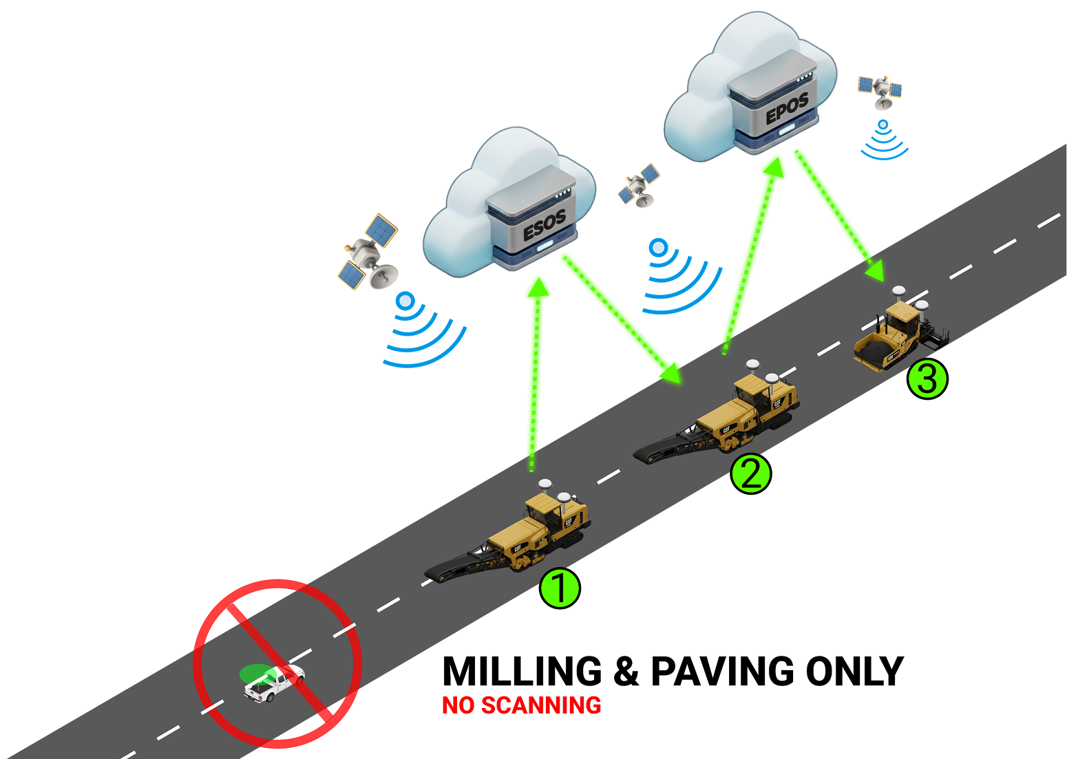
Project criteria
- • 3D Milling
- • Better Recycling
- • Automated Road Scan & Design On-Site
Are you Interested? ↓
Project criteria
Are you Interested? ↓
We will contact you soon! 🚀 Get Ready for an Amazing Experience with Exact ESOS.
Exact Street Static LiDAR is a non-contact method enabling measurements from the road shoulder without the need for traffic closures (the operator does not leave the vehicle during measurements). This allows for seamless data collection and prevents disruptions to the public.

Exact Street automated leveling combine a static LiDAR, ground control points and Total Station (TS) survey for position and elevation (X,Y,Z) or GNSS for positioning (X, Y) and digital level surveying instrument for elevations (Z). Thanks to this unique combination, we can guarantee mm accuracy of the DTM of the current technical condition of the road. This provides a defined, precise and complete look at the current state of the road.

Accuracy of DTM is characterized by height standard deviation σZ = 3 mm, relative to the project control network for compated asphalt or concrete layers.
We don’t use a mobile LiDAR due to its insufficient accuracy! See accuracy of different mobile LidAR system in tab. below.

The density of the measured points is carried out with an average observance of 2000 points/m2 2(approx. 1 point/ sq. Inch). This method ensures accurate road survey at every 2-3 cm of the surface, which is necessary for accurate repair design. All rutting, pot-holes and other local deformations are captured and identified.

Exact Street robotic LiDAR combine static LiDAR with high accuracy Total Station survey in the same time and is able to survey 5km of road in one day. The measurements are done safely from the road shoulder thus; traffic closer is not necessarily required.

